As a society our concerns about security and safety in our workplaces, schools and public buildings are played out frequently on the news, especially when there is a fire or similar emergency. This is why it is so important that these public places and buildings be sheltered from potential hazards by making up to date emergency preparedness plans. At SignWorks we take site safety and emergency evacuation very seriously. We can help you to develop safety maps and signs that help reduce risks in the event of an unfortunate emergency. The four broadest categories of Site Safety Signs are as follows:
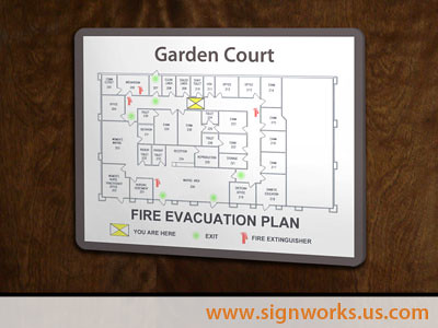
- Evacuation Maps (pictured): Easy to read floor plans that show the closest exits and location of emergency response equipment.
- Door Maps: Typically used in hotels to show clear evacuation routes from each room, along with instruction about what to do in the case of an emergency.
- Site Maps: These display all buildings, surrounding areas, major exits, and routes to evacuation zones.
- Incident Command Maps: Used by emergency response personnel, these large format maps (approx. 24 X 36 inch) are essential for safety planning and training.