Oakland, CA –Evacuation Maps For The Police Administration Building Are Now Complete and Installed!
Posted in: Industry News
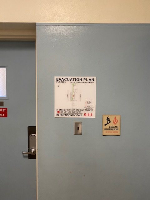 SignWorks has been working diligently with the facilities staff at the Police Administration Building and the Oakland Fire Department to complete this very large evacuation map project. The additional inspections (four in all) and input from the Fire Department culminated in the number of 14” by 14” maps increasing to 62. The Oakland Fire Department was especially concerned that the door swings and egress paths at the building were reflected accurately, especially since the building has three separate addresses and is built somewhat like a maze. Some of the doors require a key to enter, so it was important to validate that each egress path was assigned through a door that remained unlocked. And, the inspector wanted additional maps, even where the elevator lobby and stairs were within 5 feet of each other, proving the point that the fire inspectors have lots of latitude when interpreting the guidelines.
The approval process took two review cycles which was completed about a month ago. Fabricating the actual evacuation maps took some time given the quantity and a number of other projects going on at the shop. These digitally printed maps are sandwiched between a thin sheet of PVC and a 14” by 14” non-glare acrylic lens using an optically clear adhesive material.
We have several other large evacuation map projects in house at the moment including a project for San Francisco Hotel landmark (183 floor/room maps), the redo of the Epic Charter School maps due to revisions to the floor plan (56 maps) and several other smaller evacuation map projects. As with all our evacuation map projects our technician does a thorough site survey noting where the maps are needed and mapping out where things like the extinguishers, alarm pull stations, etc. are located. We also must note the accurate egress (or exit) pass. The guidelines generally include specific widths for corridors and text and the specific symbols that must be used. Once approved, we order map copies for our clients to take to the City of Oakland Fire Department for approval. In some cases we will manage the process for a client.
When (and if) your building requires fire safety signs and/or evacuation maps we hope you will give us a call at (510) 357-2000. We can offer you the technical expertise and guidance you need in complying with local guidelines. Visit our website to peruse some of our fire safety and evacuation map project photos and our blog posts.
Return to: Oakland, CA –Evacuation Maps For The Police Administration Building Are Now Complete and Installed!
Social Web